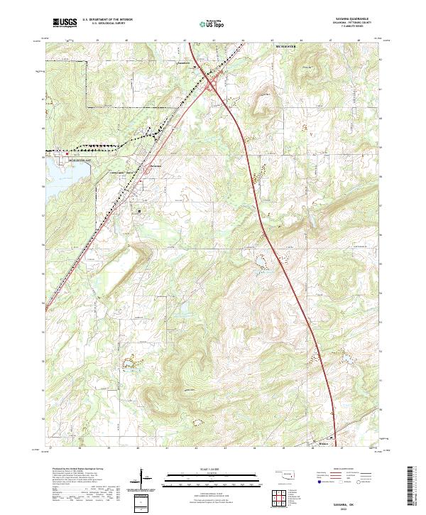
2022 Map of Savanna
USGS Topo · Published 2022About this map
Savanna and the nearby community of Chambers define the central corridor of this modern survey in Pittsburg County, situated along the path of Old Hwy 69. The landscape transitions from these settlements into a complex network of ridges and water management features to the south and east. Prominent elevations such as Shoat Mtn and Piney Mtn rise above the drainage basins of Peaceable Cr and Dancing Rabbit Cr. For those researching local heritage, the map identifies essential family and community locations, including the Savanna Cem, Chambers Cem, and Blanco Cem near the southern settlement of Blanco. The modern infrastructure is marked by several water control projects, most notably the Brushy Peaceable Cr Site 31 Reservoir and its companion sites, which have altered the natural flow of Chun Cr and Piney Br.
Find a feature on this map
53 named features on this map. Tap any name to fly to it.
Don’t see what you’re looking for? This feature index may not catch every label — zoom into the map to look around manually.
Map Details
Editions of this 2022 Savanna Map
This is the sole edition of this map. No revisions or reprints were ever made.
Other maps of this area

1898 · McAlester
USGS Topo · 1:125,000

1909 · Mc Alester
USGS Topo · 1:125,000

1950 · Mcalester
USGS Topo · 1:250,000

1962 · McAlester
USGS Topo · 1:250,000

1965 · McAlester
USGS Topo · 1:250,000
1966 · Haywood
USGS Topo · 1:24,000

1967 · Pittsburg
USGS Topo · 1:24,000

1967 · Krebs
USGS Topo · 1:24,000
1967 · Mc Alester
USGS Topo · 1:24,000
1967 · Mc Alester SW
USGS Topo · 1:24,000