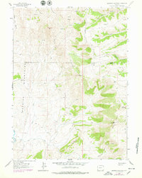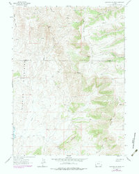
Bear River Divide dominates this high-altitude landscape along the border of Lincoln and Uinta Counties, where complex ridgelines and drainages define the high desert topography of southwest Wyoming. The 1962 data, revised in the late 1970s, reveals a land shaped by water and elevation, with numerous unnamed Springs feeding arterial waterways such as Alkali Creek and Cottonwood Creek. Human presence is minimal and practical, represented by a network of Jeep Trails and a Pack Trail that navigate the slopes near Sawtooth Mtn and The Pinnacle. A single Mine located in the northeast corner of the quadrangle points to the region's mineral interests, while prominent features like The Hogback and the Session Mountains illustrate the folding geology of the area. This record provides a clear view of the backcountry as it existed before modern development, marking the transition from the Bear River valley into the surrounding high peaks.
22 named features on this map. Tap any name to fly to it.
Don’t see what you’re looking for? This feature index may not catch every label — zoom into the map to look around manually.
3 editions found
66 maps found

1962 Bell Butte
Uinta County, WY

1962 Cumberland Gap
Uinta County, WY

1962 Elkol SW
Uinta County, WY

1962 Sawtooth Mountain
Uinta County, WY

1964 Austin Reservoir
Uinta County, WY

1964 Buck Fever Ridge
Uinta County, WY

1964 Burntfork
Uinta County, WY

1964 Leavitt Bench
Uinta County, WY

1964 Reed Reservoir
Uinta County, WY

1964 Table Mountain
Uinta County, WY

1964 Wildcat Butte
Uinta County, WY

1965 Bridger
Uinta County, WY

1965 Guild Hollow
Uinta County, WY

1965 Hague Creek
Uinta County, WY

1965 Leroy
Uinta County, WY

1965 Little Dee Creek
Uinta County, WY

1965 Meadow Draw
Uinta County, WY

1965 Meeks Cabin Reservoir
Uinta County, WY

1965 Millersville
Uinta County, WY

1965 Millis
Uinta County, WY

1965 Moslander Reservoir
Uinta County, WY

1965 Myers Reservoir
Uinta County, WY

1965 Piedmont Reservoir
Uinta County, WY

1965 Pine Knoll
Uinta County, WY

1965 Ragan
Uinta County, WY

1965 Sulphur Creek Reservoir
Uinta County, WY

1965 Three Forks
Uinta County, WY

1965 Turtle Hill
Uinta County, WY

1969 Church Butte
Uinta County, WY

1969 Hampton
Uinta County, WY

1969 Mulkay Spring
Uinta County, WY

1998 Buck Fever Ridge
Uinta County, WY

1998 Meeks Cabin Reservoir
Uinta County, WY

1998 Table Mountain
Uinta County, WY

2021 Austin Reservoir
Uinta County, WY

2021 Bell Butte
Uinta County, WY

2021 Bridger
Uinta County, WY

2021 Buck Fever Ridge
Uinta County, WY

2021 Burntfork
Uinta County, WY

2021 Church Butte
Uinta County, WY

2021 Cumberland Gap
Uinta County, WY

2021 Elkol SW
Uinta County, WY

2021 Guild Hollow
Uinta County, WY

2021 Hague Creek
Uinta County, WY

2021 Hampton
Uinta County, WY

2021 Leavitt Bench
Uinta County, WY

2021 Leroy
Uinta County, WY

2021 Little Dee Creek
Uinta County, WY

2021 Meadow Draw
Uinta County, WY

2021 Meeks Cabin Reservoir
Uinta County, WY

2021 Millersville
Uinta County, WY

2021 Millis
Uinta County, WY

2021 Moslander Reservoir
Uinta County, WY

2021 Mulkay Spring
Uinta County, WY

2021 Myers Reservoir
Uinta County, WY

2021 Piedmont Reservoir
Uinta County, WY

2021 Pine Knoll
Uinta County, WY

2021 Ragan
Uinta County, WY

2021 Reed Reservoir
Uinta County, WY

2021 Sawtooth Mountain
Uinta County, WY

2021 Sulphur Creek Reservoir
Uinta County, WY

2021 Table Mountain
Uinta County, WY

2021 Three Forks
Uinta County, WY

2021 Turtle Hill
Uinta County, WY

2021 Wildcat Butte
Uinta County, WY

2021 Woodruff Narrows
Uinta County, WY