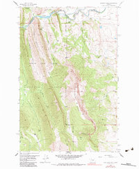
1958 Map of Sawtooth Ridge
USGS Topo · Published 1984About this map
North Fork Sun River carves through the northern landscape of this region, feeding the waters of Diversion Lake where the Diversion Dam marks a point of significant water management. In the mid-1950s, this area of the Lewis and Clark National Forest served as a nexus for mountain recreation and ranching, evidenced by the presence of Sun Canyon Lodge and the Hannan Gulch Guard Sta. The eastern edge gives way to irrigation infrastructure including the Pishkun Canal and Willow Creek Feeder Canal, highlighting the transition from the steep elevations of Sawtooth Ridge to the agricultural flats below. Names like Neal Ranch, Stecker Ranch, and Stoner Place denote the human footprint in this high country, while several Pack Trails and Jeep Trails provide the only access through the rugged drainage basins of French Gulch and Home Gulch.
Find a feature on this map
39 named features on this map. Tap any name to fly to it.
Don’t see what you’re looking for? This feature index may not catch every label — zoom into the map to look around manually.
Map Details
Editions of this 1958 Sawtooth Ridge Map
4 editions found
Other maps of this area

1903 · Saypo
USGS Topo · 1:125,000

1903 · Coopers Lake
USGS Topo · 1:125,000

1955 · Choteau
USGS Topo · 1:250,000

1957 · Choteau
USGS Topo · 1:250,000

1958 · Choteau
USGS Topo · 1:250,000

1958 · Barr Creek
USGS Topo · 1:24,000

1958 · Sawtooth Ridge
USGS Topo · 1:24,000

1958 · Patricks Basin
USGS Topo · 1:24,000

1958 · Castle Reef
USGS Topo · 1:24,000
1958 · Split Rock Lake
USGS Topo · 1:24,000