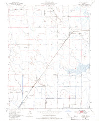
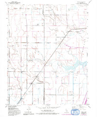
1952 Map of Saxon
USGS Topo · Published 1966About this map
Agricultural operations and water management infrastructure define this Solano and Yolo County borderland in the early 1950s. The Yolo By-Pass dominates the eastern landscape, an area noted as subject to seasonal inundation. Along the western edge of this floodway, the Sacramento Northern railroad line connects small rural hubs like Yolano and Libfarm. The area's ranching heritage is clearly marked through family-named holdings such as Maxwell Ranch, Dana Ranch, and Glide Ranch, which are interspersed with essential infrastructure including a Tank House, Flume, and various Windmill sites.
Find a feature on this map
25 named features on this map. Tap any name to fly to it.
Don’t see what you’re looking for? This feature index may not catch every label — zoom into the map to look around manually.
Map Details
Editions of this 1952 Saxon Map
5 editions found
Other maps of this area

1907 · Woodland
USGS Topo · 1:62,500

1907 · Davisville
USGS Topo · 1:62,500

1908 · Vacaville
USGS Topo · 1:62,500

1908 · Courtland
USGS Topo · 1:62,500

1915 · Swingle
USGS Topo · 1:31,680

1915 · Merritt
USGS Topo · 1:31,680

1916 · Dixon
USGS Topo · 1:31,680

1916 · Cache Slough
USGS Topo · 1:31,680
1916 · Lovdal
USGS Topo · 1:31,680

1916 · Vorden
USGS Topo · 1:31,680