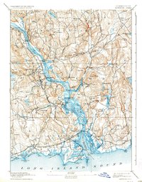
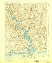
1893 Map of Saybrook
USGS Topo · Published 1936About this map
Essex and the manufacturing village of Ivoryton anchor this late nineteenth-century portrait of the lower Connecticut River valley. The landscape is defined by the New York New Haven And Hartford railroad line, which traces the western riverbank through Deep River and Chester, while the Shore Line Division crosses the river's mouth at Old Saybrook. Maritime activity is concentrated at riverfront landmarks like Goodspeeds Landing, Elys Wharf, and Saybrook Point, where the Saybrook Jetties protect the entrance from Long Island Sound.
Find a feature on this map
127 named features on this map. Tap any name to fly to it.
Don’t see what you’re looking for? This feature index may not catch every label — zoom into the map to look around manually.
Map Details
Editions of this 1893 Saybrook Map
8 editions found
Other maps of this area

1892 · New London
USGS Topo · 1:62,500

1892 · Norwich
USGS Topo · 1:62,500

1892 · Gilead
USGS Topo · 1:62,500

1893 · Guilford
USGS Topo · 1:62,500

1893 · Middletown
USGS Topo · 1:62,500

1893 · New London
USGS Topo · 1:62,500

1893 · Saybrook
USGS Topo · 1:62,500

1903 · Gardiners Island
USGS Topo · 1:62,500

1904 · Gardiners Island
USGS Topo · 1:62,500

1906 · Farmington
USGS Topo · 1:125,000