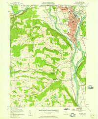
1957 Map of Sayre
USGS Topo · Published 1958About this map
The Susquehanna River and Chemung River converge at Tioga Pt, a landscape defined by the industrial and transport infrastructure of the late 1950s. The urban corridor stretching from South Waverly through Sayre to Athens reflects a dense mid-century settlement pattern, anchored by the Lehigh Valley RR and the Robert Packer Hosp. While the railroads remained active, vestiges of earlier eras are visible in the Lackawanna and Western Canal (Abandoned), which traces the riverbank south toward Milan.
Find a feature on this map
91 named features on this map. Tap any name to fly to it.
Don’t see what you’re looking for? This feature index may not catch every label — zoom into the map to look around manually.
Map Details
Editions of this 1957 Sayre Map
4 editions found
Other maps of this area

1902 · Waverly
USGS Topo · 1:62,500

1903 · Owego
USGS Topo · 1:62,500

1905 · Watkins Glen
USGS Topo · 1:125,000

1906 · Catatonk
USGS Topo · 1:125,000

1923 · Towanda
USGS Topo · 1:62,500

1926 · Towanda
USGS Topo · 1:62,500

1939 · Sayre
USGS Topo · 1:62,500

1942 · Sayre
USGS Topo · 1:62,500

1943 · Towanda
USGS Topo · 1:62,500

1948 · Sayre
USGS Topo · 1:62,500