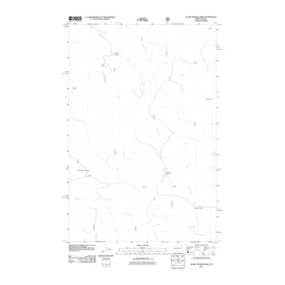
2011 Map of Scairt Woman Draw
USGS Topo · Published 2011About this map
Scairt Woman Oil Field defines the industrial footprint of this Western North Dakota landscape, where energy extraction meets traditional ranching operations. The terrain is deeply incised by the eponymous Scairt Woman Draw and a complex drainage system including Beicegel Creek, Camp Creek, and Magpie Creek. Human activity is centered on isolated ranching outposts such as Lillibridge Ranch and L-Tachenko Ranch, connected by a network of Forest Service and local roads like 713 and 807. The presence of Palunak Dam on the eastern edge suggests localized water management in this arid environment. This 2011 survey illustrates the modern configuration of the Little Missouri National Grassland area, balancing livestock production with the infrastructure of the Bakken oil region.
Find a feature on this map
21 named features on this map. Tap any name to fly to it.
Don’t see what you’re looking for? This feature index may not catch every label — zoom into the map to look around manually.
Map Details
Editions of this 2011 Scairt Woman Draw Map
This is the sole edition of this map. No revisions or reprints were ever made.
Other maps of this area

1953 · Watford City
USGS Topo · 1:250,000

1957 · Watford City
USGS Topo · 1:250,000

1963 · Gorham NW
USGS Topo · 1:24,000

1963 · Fairfield
USGS Topo · 1:24,000

1963 · Gorham
USGS Topo · 1:24,000

1967 · Watford City
USGS Topo · 1:250,000

1974 · Wolf Coulee
USGS Topo · 1:24,000

1974 · Grassy Butte SW
USGS Topo · 1:24,000

1974 · Squaretop Butte
USGS Topo · 1:24,000

1974 · Buckskin Butte
USGS Topo · 1:24,000