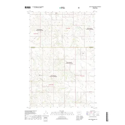
2017 Map of Scairt Woman Draw
USGS Topo · Published 2017About this map
Little Missouri National Grassland dominates this landscape on the border of McKenzie and Billings Counties. The terrain is defined by a dense network of coulees and draws, most notably Scairt Woman Draw, which carves through the central portion of the quadrangle. Water distribution follows these natural contours, with Beicegel Cr and Magpie Cr draining the northern and southern reaches respectively. The rural infrastructure of the 2010s is represented by a series of gravel and section roads, including E Beicegel Cr Rd and Upper Magpie Rd, which provide access to this remote grazing and conservation area. The map reveals the systematic township and range divisions that still govern land use in this part of the North Dakota badlands.
Find a feature on this map
22 named features on this map. Tap any name to fly to it.
Don’t see what you’re looking for? This feature index may not catch every label — zoom into the map to look around manually.
Map Details
Editions of this 2017 Scairt Woman Draw Map
This is the sole edition of this map. No revisions or reprints were ever made.
Other maps of this area

1953 · Watford City
USGS Topo · 1:250,000

1957 · Watford City
USGS Topo · 1:250,000

1963 · Gorham NW
USGS Topo · 1:24,000

1963 · Fairfield
USGS Topo · 1:24,000

1963 · Gorham
USGS Topo · 1:24,000

1967 · Watford City
USGS Topo · 1:250,000

1974 · Wolf Coulee
USGS Topo · 1:24,000

1974 · Grassy Butte SW
USGS Topo · 1:24,000

1974 · Squaretop Butte
USGS Topo · 1:24,000

1974 · Buckskin Butte
USGS Topo · 1:24,000