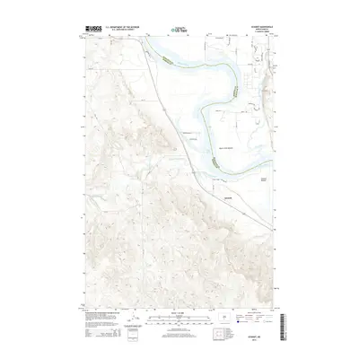
2014 Map of Schmidt
USGS Topo · Published 2014About this map
The Missouri River carves a deep path through the landscape of the Burleigh and Morton County border, framing a region defined by its wide floodplains and dramatic elevation changes. Along the eastern banks, the Univ of Mary overlooks the sweeping Apple Creek Bottom, where Apple Creek meanders toward its confluence with the main river channel. This area serves as a primary drainage point for the surrounding highlands, including the winding course of the Little Heart River which enters from the west to join the waters of Lake Oahe. The small settlement of Schmidt occupies a strategic position on the western terrace, just above the Schmidt Bottom. The intricate contour lines illustrate the sharp rise from the river valley into the broken terrain to the west, highlighting the geographic constraints that have shaped local road networks and land use along the Missouri's course.
Find a feature on this map
32 named features on this map. Tap any name to fly to it.
Don’t see what you’re looking for? This feature index may not catch every label — zoom into the map to look around manually.
Map Details
Editions of this 2014 Schmidt Map
This is the sole edition of this map. No revisions or reprints were ever made.
Other maps of this area

1907 · Bismarck
USGS Topo · 1:125,000

1950 · Bismarck
USGS Topo · 1:24,000

1951 · Menoken SW
USGS Topo · 1:24,000

1951 · Bismarck
USGS Topo · 1:62,500

1951 · Mandan
USGS Topo · 1:24,000

1951 · Menoken
USGS Topo · 1:62,500

1954 · Bismarck
USGS Topo · 1:250,000

1958 · Bismarck
USGS Topo · 1:250,000

1962 · Sugarloaf Butte
USGS Topo · 1:24,000

1962 · Schmidt
USGS Topo · 1:24,000