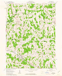
1961 Map of Scio
USGS Topo · Published 1963About this map
Scio and New Rumley anchor this early 1960s study of eastern Ohio, where the ridge-and-valley landscape of the Old Seven Ranges is defined by a mix of agriculture and extraction. The village of New Rumley is notably identified by the Gen Custer Mon, while the western edge of the quadrangle is shaped by the Leesville Reservoir and nearby Stony Lake. The topography is marked by a network of drainage including McGuire Creek and the Conotton Creek, along which the Pennsylvania and Chicago and St Louis railroads track the valley floor.
Find a feature on this map
42 named features on this map. Tap any name to fly to it.
Don’t see what you’re looking for? This feature index may not catch every label — zoom into the map to look around manually.
Map Details
Editions of this 1961 Scio Map
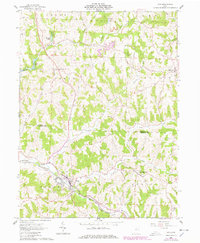
2 editions found
Other maps of this area

1901 · Cadiz
USGS Topo · 1:62,500

1902 · Scio
USGS Topo · 1:62,500

1903 · Cadiz
USGS Topo · 1:62,500

1904 · Scio
USGS Topo · 1:62,500

1905 · Salineville
USGS Topo · 1:62,500

1910 · Carrollton
USGS Topo · 1:62,500

1912 · Carrollton
USGS Topo · 1:62,500

1951 · Canton
USGS Topo · 1:250,000

1953 · Canton
USGS Topo · 1:250,000

1957 · Canton
USGS Topo · 1:250,000