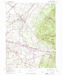
1944 Map of Scotland
USGS Topo · Published 1974About this map
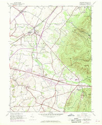
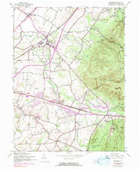
Conococheague Creek carves a central path through this Franklin County landscape, anchoring a network of small agricultural and rail-oriented settlements. The village of Scotland serves as a notable hub where the Penn Central rail lines intersect the drainage of the creek, and is home to the Soldiers Orphan Sch. To the east, the terrain rises sharply into the ridgelines of Southampton and Greene townships, featuring prominent landmarks such as Stony Knob and Eagle Rock.
Find a feature on this map
45 named features on this map. Tap any name to fly to it.
Don’t see what you’re looking for? This feature index may not catch every label — zoom into the map to look around manually.
Map Details
Editions of this 1944 Scotland Map
7 editions found
Other maps of this area

1902 · Chambersburg
USGS Topo · 1:62,500

1909 · Fairfield
USGS Topo · 1:62,500

1919 · Newville
USGS Topo · 1:62,500

1923 · Shippensburg
USGS Topo · 1:62,500

1942 · Hagerstown
USGS Topo · 1:125,000

1942 · Gettysburg
USGS Topo · 1:125,000

1943 · Hagerstown
USGS Topo · 1:125,000

1943 · Chambersburg
USGS Topo · 1:62,500

1943 · Shippensburg
USGS Topo · 1:62,500

1944 · Scotland
USGS Topo · 1:31,680
Featured Places
- Chambersburg, PA
- Fayetteville, Greene Township
- Guilford Township, PA
- Scotland, Greene Township
- Greene Township, PA