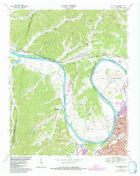
1968 Map of Scottsboro
USGS Topo · Published 1984About this map
The Cumberland River carves a dramatic path through this 1968 survey of Davidson County, defining the agricultural and industrial landscape of Cockrill Bend, Whites Bend, and Bells Bend. This riverine geometry is dominated by the State Penitentiary along the eastern shore, while Cheatham Lake begins to broaden the waterway to the west. On the higher ground, rural communities like Scottsboro and Horton Heights are shown in their late-1960s state, just as the suburban footprint of West Meade and Brookmeade begins to expand outward from Nashville.
Find a feature on this map
69 named features on this map. Tap any name to fly to it.
Don’t see what you’re looking for? This feature index may not catch every label — zoom into the map to look around manually.
Map Details
Editions of this 1968 Scottsboro Map
4 editions found
Other maps of this area

1903 · Nashville
USGS Topo · 1:125,000

1930 · White Bluff
USGS Topo · 1:62,500

1931 · Ridgetop
USGS Topo · 1:62,500

1932 · Nashville
USGS Topo · 1:62,500

1933 · White Bluff
USGS Topo · 1:62,500

1935 · Ridgetop
USGS Topo · 1:62,500

1952 · Nashville West
USGS Topo · 1:24,000
1953 · Oak Hill
USGS Topo · 1:24,000

1955 · Whites Creek
USGS Topo · 1:24,000

1955 · Forest Grove
USGS Topo · 1:24,000