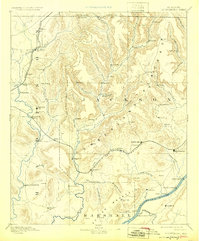
1892 Map of Scottsboro
USGS Topo · Published 1925About this map
Scottsboro serves as the focal point of this late 19th-century survey, situated along the Memphis and Charleston Railroad as it traverses the foothills of the Cumberland Plateau. The landscape is defined by the significant river systems of the Tennessee River to the south and the Paint Rock River winding through the center. Small agricultural settlements and community centers like New Hope (Vienna), Owens Cross Roads, and New Market are well-established, connected by a network of local roads and the Nashville Chattanooga and St. Louis Railroad in the northwest. River-based commerce is evident through numerous riverfront access points such as Larkin Landing and Caldwell's Ferry, which provided critical transportation links before modern bridging. The topography reveals deep coves like Kennamer Cove and Williams Cove, illustrating how the early settlers navigated the steep terrain of Gunter Mountain and the surrounding highlands.
Find a feature on this map
91 named features on this map. Tap any name to fly to it.
Don’t see what you’re looking for? This feature index may not catch every label — zoom into the map to look around manually.
Map Details
Editions of this 1892 Scottsboro Map
5 editions found
Other maps of this area

1885 · Gadsden
USGS Topo · 1:125,000

1886 · Stevenson
USGS Topo · 1:125,000

1888 · Cullman
USGS Topo · 1:125,000

1888 · Gadsden
USGS Topo · 1:125,000

1888 · Scottsboro
USGS Topo · 1:125,000

1888 · Huntsville
USGS Topo · 1:125,000

1892 · Cullman
USGS Topo · 1:125,000

1892 · Huntsville
USGS Topo · 1:125,000

1892 · Scottsboro
USGS Topo · 1:125,000

1892 · Stevenson
USGS Topo · 1:125,000