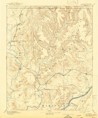
1892 Map of Scottsboro
USGS Topo · Published 1943About this map
The Tennessee River and the Cumberland Mountain plateau dominate this late-19th-century survey of Northeast Alabama. The landscape is defined by the sharp transition from the broad river valley to the steep, dissected coves and branches of the plateau, including Wright's Cove and Maynard's Cove. Settlement patterns follow the fertile bottoms of the Paint Rock River and its numerous forks, like Larkin Fork and Estills Fork.
Find a feature on this map
86 named features on this map. Tap any name to fly to it.
Don’t see what you’re looking for? This feature index may not catch every label — zoom into the map to look around manually.
Map Details
Editions of this 1892 Scottsboro Map
5 editions found
Other maps of this area

1885 · Gadsden
USGS Topo · 1:125,000

1886 · Stevenson
USGS Topo · 1:125,000

1888 · Cullman
USGS Topo · 1:125,000

1888 · Gadsden
USGS Topo · 1:125,000

1888 · Scottsboro
USGS Topo · 1:125,000

1888 · Huntsville
USGS Topo · 1:125,000

1892 · Cullman
USGS Topo · 1:125,000

1892 · Huntsville
USGS Topo · 1:125,000

1892 · Scottsboro
USGS Topo · 1:125,000

1892 · Stevenson
USGS Topo · 1:125,000