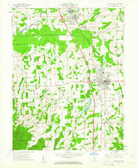
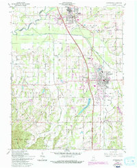
1960 Map of Scottsburg
USGS Topo · Published 1961About this map
Scottsburg and the nearby town of Austin anchor this 1960 landscape, where the Pennsylvania Railroad corridor dictates the north-south axis of development. This era captures the transition of southern Indiana’s rural economy, shown through the dense network of drainage projects like Gammie Thomas Ditch and W L McClain Ditch that reclaimed the flatlands for agriculture. Beyond the organized grid of the county seat, the terrain becomes more varied toward the south, leading into the timbered ridges of Clark State Forest.
Find a feature on this map
109 named features on this map. Tap any name to fly to it.
Don’t see what you’re looking for? This feature index may not catch every label — zoom into the map to look around manually.
Map Details
Editions of this 1960 Scottsburg Map
5 editions found
Other maps of this area

1947 · Scottsburg
USGS Topo · 1:24,000

1949 · Henryville
USGS Topo · 1:24,000

1955 · South Boston
USGS Topo · 1:24,000

1956 · Otisco
USGS Topo · 1:24,000

1956 · Blocher
USGS Topo · 1:24,000

1956 · Deputy
USGS Topo · 1:24,000

1956 · Louisville
USGS Topo · 1:250,000

1958 · Little York
USGS Topo · 1:24,000

1959 · Tampico
USGS Topo · 1:24,000

1959 · Crothersville
USGS Topo · 1:24,000