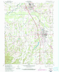
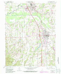
1960 Map of Scottsburg
USGS Topo · Published 1994About this map
The Pennsylvania Railroad corridor anchors this 1960s study of central Scott County, connecting the industrial and residential centers of Austin and Scottsburg. This era captures the transition of the regional landscape as Interstate 31 bypasses the older town centers at Interchange 33 and Interchange 29. The municipal footprint of Scottsburg is clearly defined by landmarks such as the Scottsburg Memorial Hospital, the Fairgrounds, and the Scottsburg Reservoir, while the surrounding agricultural lands are dotted with traditional rural hubs like Vienna and Leota. Significant genealogical data is present through several country houses of worship and burial grounds, including Mt Zion Ch, New Providence Ch, and Everitt Cem. To the south, the terrain shifts into the wooded elevations of the Clark State Forest, providing a sharp contrast to the hydrologically managed northern plains where Stucker Ditch and Old Ox Creek drain the fertile bottomlands.
Find a feature on this map
75 named features on this map. Tap any name to fly to it.
Don’t see what you’re looking for? This feature index may not catch every label — zoom into the map to look around manually.
Map Details
Editions of this 1960 Scottsburg Map
5 editions found
Other maps of this area

1947 · Scottsburg
USGS Topo · 1:24,000

1949 · Henryville
USGS Topo · 1:24,000

1955 · South Boston
USGS Topo · 1:24,000

1956 · Otisco
USGS Topo · 1:24,000

1956 · Blocher
USGS Topo · 1:24,000

1956 · Deputy
USGS Topo · 1:24,000

1956 · Louisville
USGS Topo · 1:250,000

1958 · Little York
USGS Topo · 1:24,000

1959 · Tampico
USGS Topo · 1:24,000

1959 · Crothersville
USGS Topo · 1:24,000