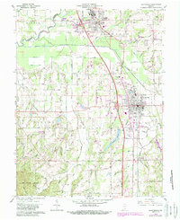
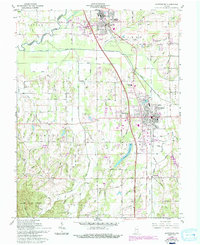
1960 Map of Scottsburg
USGS Topo · Published 1988About this map
Scottsburg serves as the focal point of this Scott County survey, showing the city's mid-century expansion along the Pennsylvania Railroad and the newly developed highway interchanges. The landscape transitions from the developed grids of Austin and Scottsburg to the dense woodlands of Clark State Forest in the southwest. Water management is a defining characteristic of the region, evidenced by the extensive network of drainage channels like Ox Ditch and Plain Drain, alongside the Scottsburg Reservoir. Local civic life is anchored by landmarks such as the Fairgrounds, the Scottsburg Memorial Hospital, and the Vienna Sch. The map preserves the locations of numerous family burial grounds, including the Cravens Cem and Spurgeon Cem, which provide essential geographic markers for researchers tracing the heritage of this Southern Indiana agricultural and transit corridor.
Find a feature on this map
83 named features on this map. Tap any name to fly to it.
Don’t see what you’re looking for? This feature index may not catch every label — zoom into the map to look around manually.
Map Details
Editions of this 1960 Scottsburg Map
5 editions found
Other maps of this area

1947 · Scottsburg
USGS Topo · 1:24,000

1949 · Henryville
USGS Topo · 1:24,000

1955 · South Boston
USGS Topo · 1:24,000

1956 · Otisco
USGS Topo · 1:24,000

1956 · Blocher
USGS Topo · 1:24,000

1956 · Deputy
USGS Topo · 1:24,000

1956 · Louisville
USGS Topo · 1:250,000

1958 · Little York
USGS Topo · 1:24,000

1959 · Tampico
USGS Topo · 1:24,000

1959 · Crothersville
USGS Topo · 1:24,000