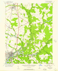
1955 Map of Seaford East
USGS Topo · Published 1957About this map
Seaford and Bridgeville serve as the primary hubs in this mid-century survey of western Sussex County, where the landscape is defined by the winding course of the Nanticoke River. The river's influence on local development is evident in the cluster of waterfront landmarks, including Cherrytree Landing and Nanticoke Memorial Hospital. The rural character of the surrounding districts is marked by numerous drainage ditches and branches, such as Gravelly Branch and Turkey Branch, which supported the area's agricultural base.
Find a feature on this map
51 named features on this map. Tap any name to fly to it.
Don’t see what you’re looking for? This feature index may not catch every label — zoom into the map to look around manually.
Map Details
Editions of this 1955 Seaford East Map
2 editions found
Other maps of this area

1915 · Seaford
USGS Topo · 1:62,500

1917 · Millsboro
USGS Topo · 1:62,500

1918 · Cedar Creek
USGS Topo · 1:62,500

1918 · Harrington
USGS Topo · 1:62,500

1919 · Cedar Creek
USGS Topo · 1:62,500

1938 · Cedar Creek
USGS Topo · 1:62,500

1938 · Millsboro
USGS Topo · 1:62,500

1944 · Cedar Creek
USGS Topo · 1:62,500

1944 · Millsboro
USGS Topo · 1:62,500

1944 · Seaford
USGS Topo · 1:62,500