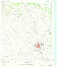
1960 Map of Sealy
USGS Topo · Published 1975About this map
Sealy serves as the central hub of this 1960 Austin County landscape, where the intersection of the Gulf Colorado and Santa Fe and the Missouri Kansas Texas railroads defines the local commerce and geography. The map reveals a transition from the structured street grid of the town center—complete with its Hospital and Athletic Field—to the surrounding prairie and bottomlands. To the north and east, small agrarian communities like Millheim, Peters, and Macedonia are linked by rural routes such as Cat Spring Road. The drainage patterns are intricate, with Bullinger Creek and Allens Creek winding through the terrain, while local industry is noted through scattered Gas Wells and Gravel Pits. This survey captures the region before extensive modern expansion, preserving the locations of family-connected landmarks like Macedonia Cem and Peters Lake.
Find a feature on this map
31 named features on this map. Tap any name to fly to it.
Don’t see what you’re looking for? This feature index may not catch every label — zoom into the map to look around manually.
Map Details
Editions of this 1960 Sealy Map
Other maps of this area

1953 · Seguin
USGS Topo · 1:250,000

1956 · Bellville
USGS Topo · 1:62,500

1956 · Sealy
USGS Topo · 1:62,500

1956 · Wallis
USGS Topo · 1:62,500

1957 · Eagle Lake
USGS Topo · 1:62,500

1958 · Seguin
USGS Topo · 1:250,000

1960 · Wallis
USGS Topo · 1:24,000

1960 · San Felipe
USGS Topo · 1:24,000
1960 · Rexville
USGS Topo · 1:24,000
1960 · Sealy
USGS Topo · 1:24,000