
1970 Map of Seaman Wash
USGS Topo · Published 1973About this map
Seaman Range dominates this 1970s topographic record, where the arid high-desert topography of Lincoln County is defined by dramatic elevation changes. The eastern portion of the map is marked by the rugged limestone peaks of the range, giving way to the Coal Valley (Depression) in the northwest. This drainage pattern is centered on Seaman Wash, which threads through the distinctive Seaman Narrows as it descends toward the valley floor.
Find a feature on this map
7 named features on this map. Tap any name to fly to it.
Don’t see what you’re looking for? This feature index may not catch every label — zoom into the map to look around manually.
Map Details
Editions of this 1970 Seaman Wash Map
2 editions found
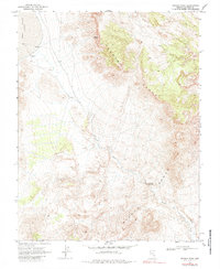
Other maps of this area

1954 · Caliente
USGS Topo · 1:250,000

1959 · Caliente
USGS Topo · 1:250,000

1970 · Hiko NE
USGS Topo · 1:24,000

1970 · Oreana Spring
USGS Topo · 1:24,000

1970 · Fossil Peak
USGS Topo · 1:24,000
1970 · Weepah Spring
USGS Topo · 1:24,000
1970 · White River Narrows
USGS Topo · 1:24,000

1985 · Mail Summit
USGS Topo · 1:24,000

1985 · Coal Valley Reservoir
USGS Topo · 1:24,000
1985 · Murphy Gap SE
USGS Topo · 1:24,000