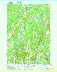
1960 Map of Searsmont
USGS Topo · Published 1979About this map
The St George River winds through the heart of Waldo and Knox Counties, defining the agricultural and industrial layout of this mid-Maine landscape. This 1960 survey, updated with 1973 revisions, reveals a dense network of crossroads settlements and family-named corners such as Bickfords Corner, Athearns Corner, and Gushees Corner. The economy of the era is evident in the scattered Gravel Pits and the historical footprint of Shermans Mill along the water.
Find a feature on this map
67 named features on this map. Tap any name to fly to it.
Don’t see what you’re looking for? This feature index may not catch every label — zoom into the map to look around manually.
Map Details
Editions of this 1960 Searsmont Map
4 editions found
Other maps of this area

1904 · Rockland
USGS Topo · 1:62,500

1906 · Rockland
USGS Topo · 1:62,500

1913 · Waldoboro
USGS Topo · 1:48,000

1915 · Waldoboro
USGS Topo · 1:62,500

1915 · Belfast
USGS Topo · 1:62,500

1916 · Liberty
USGS Topo · 1:62,500

1917 · Belfast
USGS Topo · 1:62,500

1941 · Belfast
USGS Topo · 1:62,500

1941 · Rockland
USGS Topo · 1:62,500

1941 · Waldoboro
USGS Topo · 1:62,500