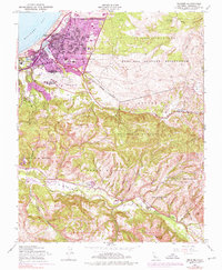
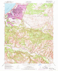
1947 Map of Seaside
USGS Topo · Published 1976About this map
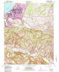
The Fort Ord Military Reservation and the growing urban centers of Seaside and Del Rey Oaks define the northern landscape of this mid-century survey. While the coast is dominated by industrial and military presence, including the Southern Pacific rail line and the U S Navy Post Graduate Sch, the inland areas reflect a more rural, topographical character. The map identifies specific early property holdings and ranch sites such as James Meadows, Los Laurelles (Ranson), and Corral De Tierra (Mc Cobb), which are essential for tracing local land ownership history.
Find a feature on this map
57 named features on this map. Tap any name to fly to it.
Don’t see what you’re looking for? This feature index may not catch every label — zoom into the map to look around manually.
Map Details
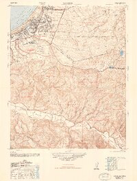
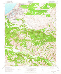
Editions of this 1947 Seaside Map
5 editions found
Other maps of this area

1910 · Salinas
USGS Topo · 1:31,680

1912 · Salinas
USGS Topo · 1:62,500

1913 · Monterey
USGS Topo · 1:62,500

1918 · Point Sur
USGS Topo · 1:62,500

1920 · Jamesburg
USGS Topo · 1:48,000

1921 · Jamesburg
USGS Topo · 1:62,500

1925 · Point Sur
USGS Topo · 1:62,500

1939 · Jamesburg
USGS Topo · 1:62,500

1940 · Salinas
USGS Topo · 1:62,500

1940 · Jamesburg
USGS Topo · 1:62,500