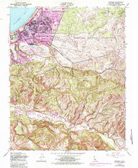
1947 Map of Seaside
USGS Topo · Published 1985About this map
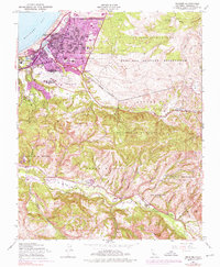
The Fort Ord Military Reservation dominates the northeastern landscape of this coastal survey, highlighting the significant military footprint on the Monterey Peninsula following World War II. The urban center of Seaside is shown in detail, including neighborhoods like Del Monte Heights and Noche Buena, alongside critical infrastructure such as the Southern Pacific railroad and the Monterey Municipal Airport. The map documents a period of rapid development, with newer schools like Fremont High Sch and Martin Luther King Jr High Sch appearing alongside established landmarks like the U S Navy Post Graduate Sch. To the south, the topography shifts from the developed coast of Monterey Bay toward the interior heights of Saddle Mountain and Snivleys Ridge, where the Carmel River winds through Los Laurelles. This transition from military and urban clusters to the valley's rural landscape captures the dual character of the region during the mid-20th century.
Find a feature on this map
34 named features on this map. Tap any name to fly to it.
Don’t see what you’re looking for? This feature index may not catch every label — zoom into the map to look around manually.
Map Details
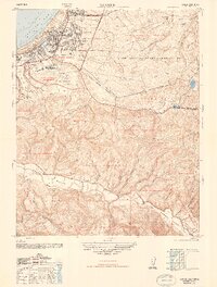
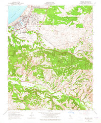
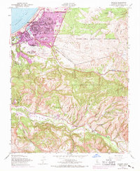
Editions of this 1947 Seaside Map
5 editions found
Other maps of this area

1910 · Salinas
USGS Topo · 1:31,680

1912 · Salinas
USGS Topo · 1:62,500

1913 · Monterey
USGS Topo · 1:62,500

1918 · Point Sur
USGS Topo · 1:62,500

1920 · Jamesburg
USGS Topo · 1:48,000

1921 · Jamesburg
USGS Topo · 1:62,500

1925 · Point Sur
USGS Topo · 1:62,500

1939 · Jamesburg
USGS Topo · 1:62,500

1940 · Salinas
USGS Topo · 1:62,500

1940 · Jamesburg
USGS Topo · 1:62,500