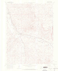
1965 Map of Sedalia
USGS Topo · Published 1967About this map
Sedalia serves as a central junction on this mid-1960s survey, situated where the Atchison Topeka and Santa Fe and Denver and Rio Grande Western railroads converge. The landscape is defined by the drainage basins of Plum Creek and its branches, including West Plum Creek and East Plum Creek. This period reveals a mix of agricultural heritage and early suburban transition, with older landmarks like the Ute Mine and Quarry appearing alongside residential developments like Beverly Hills and the Littleton Sedalia Landing Area. Educational and spiritual foundations of the community are marked by the Gann Sch, Round Top Sch, and the Sacred Heart Retreat House. Notable terrain features such as Wildcat Point and Raccoon Knob provide high-ground overlooks within the expansive Daniels Park.
Find a feature on this map
31 named features on this map. Tap any name to fly to it.
Don’t see what you’re looking for? This feature index may not catch every label — zoom into the map to look around manually.
Map Details
Editions of this 1965 Sedalia Map
4 editions found
Other maps of this area

1890 · East Denver
USGS Topo · 1:125,000

1893 · Platte Canyon
USGS Topo · 1:125,000

1894 · Castle Rock
USGS Topo · 1:125,000

1899 · West Denver
USGS Topo · 1:125,000

1913 · Castle Rock
USGS Topo · 1:125,000

1935 · East Denver Nos. 3 and 4
USGS Topo · 1:48,000

1940 · Castle Rock
USGS Topo · 1:62,500

1942 · Highland Ranch
USGS Topo · 1:31,680

1942 · Parker
USGS Topo · 1:31,680

1942 · Littleton
USGS Topo · 1:31,680