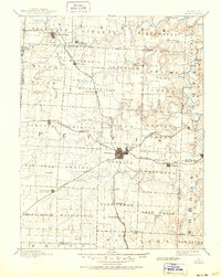
1894 Map of Sedalia
USGS Topo · Published 1950About this map
Sedalia serves as the focal point of this late 19th-century landscape, positioned at a critical junction of several major rail lines that shaped the regional economy. The Missouri Pacific Railroad and the Missouri Kansas and Texas Railroad intersect here, facilitating the growth of surrounding agricultural communities. To the north, the Black Water River and Lamine River wind through the terrain, while the Sedalia Warsaw And Southwestern RR pushes south toward Mora.
Find a feature on this map
85 named features on this map. Tap any name to fly to it.
Don’t see what you’re looking for? This feature index may not catch every label — zoom into the map to look around manually.
Map Details
Editions of this 1894 Sedalia Map
5 editions found

Other maps of this area

1885 · Warrensburg
USGS Topo · 1:125,000

1887 · Clinton
USGS Topo · 1:125,000

1887 · Sedalia
USGS Topo · 1:125,000

1887 · Warsaw
USGS Topo · 1:125,000

1887 · Warrensburg
USGS Topo · 1:125,000

1888 · Versailles
USGS Topo · 1:125,000

1888 · Boonville
USGS Topo · 1:125,000

1889 · Lexington
USGS Topo · 1:125,000

1890 · Glasgow
USGS Topo · 1:125,000

1890 · Marshall
USGS Topo · 1:125,000