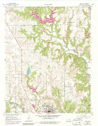
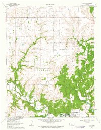
1962 Map of Sedan
USGS Topo · Published 1986About this map
The town of Sedan serves as the focal point of this Chautauqua County survey, where the Missouri Pacific railroad skirts the southern edge of the community. The landscape is defined by the winding paths of North Caney Creek and Middle Caney Creek, which shape the local drainage and topography. To the north, Quivira Camp and Union Chapel mark significant community gathering points, while the eastern section shows the settlement of Grafton situated near Bachelor Creek.
Find a feature on this map
32 named features on this map. Tap any name to fly to it.
Don’t see what you’re looking for? This feature index may not catch every label — zoom into the map to look around manually.
Map Details
Editions of this 1962 Sedan Map
3 editions found
Other maps of this area

1885 · Sedan
USGS Topo · 1:125,000

1889 · Sedan
USGS Topo · 1:125,000

1955 · Wichita
USGS Topo · 1:250,000

1958 · Wichita
USGS Topo · 1:250,000
1962 · Oak Valley
USGS Topo · 1:24,000

1962 · Moline
USGS Topo · 1:24,000
1962 · Elk Falls
USGS Topo · 1:24,000

1962 · Sedan
USGS Topo · 1:24,000

1962 · Elgin NE
USGS Topo · 1:24,000
1962 · Elgin
USGS Topo · 1:24,000