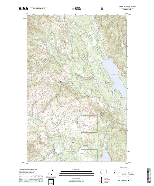
2024 Map of Seeley Lake West
USGS Topo · Published 2024About this map
Seeley Lake and the Clearwater River corridor form the focal point of this western Montana landscape, showing the transition between established lakeside settlements and the expansive reaches of the Lolo National Forest. The map documents a dense network of forest service roads and recreational trails, such as the Starbuck Trl and Archibald Cr Loop, which provide access to high-elevation water bodies like Lake Elsina and Hidden Lake. Historical land use is evident in the presence of the Cahoon Ranch and smaller timber or ranching outposts along the valley floor. To the south, Placid Lake and its surrounding wetlands near Placid Creek illustrate the complex hydrology of the region, while landmarks like Smurf Hill and Tuppers Lake provide specific points of interest for local history and geographic orientation.
Find a feature on this map
62 named features on this map. Tap any name to fly to it.
Don’t see what you’re looking for? This feature index may not catch every label — zoom into the map to look around manually.
Map Details
Editions of this 2024 Seeley Lake West Map
This is the sole edition of this map. No revisions or reprints were ever made.
Other maps of this area

1902 · Ovando
USGS Topo · 1:125,000

1905 · Ovando
USGS Topo · 1:125,000

1921 · Elbow Lake
USGS Topo · 1:125,000

1955 · Choteau
USGS Topo · 1:250,000

1957 · Choteau
USGS Topo · 1:250,000

1958 · Choteau
USGS Topo · 1:250,000

1962 · Choteau
USGS Topo · 1:250,000

1965 · Upper Jocko Lake
USGS Topo · 1:24,000
1965 · Gold Creek Peak
USGS Topo · 1:24,000

1965 · Seeley Lake West
USGS Topo · 1:24,000