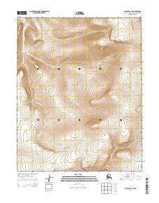
2014 Map of Selawik A-2 SW
USGS Topo · Published 2014About this map
Selawik Hills dominate the eastern landscape of this Arctic region, where the terrain transitions from high ridges to the drainage basins of the Mangoak River and Fish River. Mapping conducted by the U.S. Geological Survey in 2014 documents a wilderness environment characterized by the natural flow of these water systems through the Northwest Arctic Borough. The meandering path of the Mangoak River across the western half of the map illustrates the complex hydrology of this subarctic tundra, while the southeast corner captures the headwaters or tributary segments of the Fish River. This survey provides a baseline of the land's elevation and water distribution within the t7n r6w, t7n r5w, t8n r6w, and t8n r5w township boundaries.
Find a feature on this map
7 named features on this map. Tap any name to fly to it.
Don’t see what you’re looking for? This feature index may not catch every label — zoom into the map to look around manually.
Map Details
Editions of this 2014 Selawik A-2 SW Map
This is the sole edition of this map. No revisions or reprints were ever made.
Other maps of this area

1951 · Candle
USGS Topo · 1:250,000

1951 · Selawik
USGS Topo · 1:250,000

1954 · Candle D-2
USGS Topo · 1:63,360

1955 · Candle
USGS Topo · 1:250,000
1955 · Candle D-3
USGS Topo · 1:63,360

1955 · Selawik A-3
USGS Topo · 1:63,360

1957 · Selawik
USGS Topo · 1:250,000

1964 · Candle
USGS Topo · 1:250,000
1985 · Selawik A-2
USGS Topo · 1:63,360
2014 · Selawik A-2 SE
USGS Topo · 1:25,000