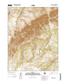
2015 Map of Selawik D-3 SW
USGS Topo · Published 2015About this map
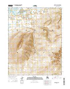
The Singauruk River meanders across the southeastern and southwestern reaches of this Northwest Arctic landscape, carving a drainage path through the high-elevation terrain of the t16n r8w and t16n r7w townships. The topography is dominated by dramatic contour gradients, rising toward central ridgelines that divide the river's path from smaller northern tributaries like Portage Cr. This 2015 survey reflects a wilderness environment defined almost entirely by its physical geography, where the absence of roads or permanent structures emphasizes the primacy of the hydrological network. The Public Land Survey System grid provides the primary human-imposed structure over these remote reaches of the Northwest Arctic Borough, marking the transitions between the eighth and seventh ranges of the northern townships.
Find a feature on this map
6 named features on this map. Tap any name to fly to it.
Don’t see what you’re looking for? This feature index may not catch every label — zoom into the map to look around manually.
Map Details
Editions of this 2015 Selawik D-3 SW Map
This is the sole edition of this map. No revisions or reprints were ever made.
Other maps of this area

1951 · Selawik
USGS Topo · 1:250,000

1955 · Selawik D-4
USGS Topo · 1:63,360

1955 · Selawik C-3
USGS Topo · 1:63,360

1955 · Selawik D-3
USGS Topo · 1:63,360

1955 · Selawik C-4
USGS Topo · 1:63,360

1957 · Selawik
USGS Topo · 1:250,000
2015 · Selawik D-3 SE
USGS Topo · 1:25,000
2015 · Selawik D-3 NW
USGS Topo · 1:25,000
2015 · Selawik D-4 NE
USGS Topo · 1:25,000
2015 · Selawik D-4 SE
USGS Topo · 1:25,000