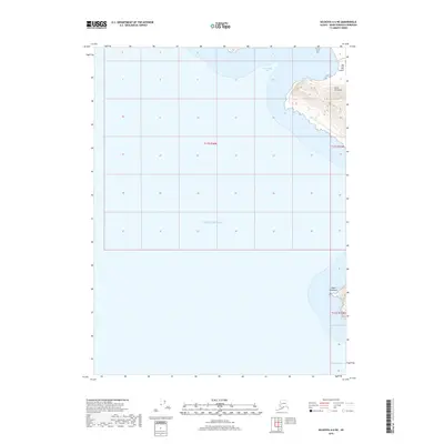
2018 Map of Seldovia A-6 NE
USGS Topo · Published 2018About this map
Cape Elizabeth defines the southeastern corner of this maritime landscape, where the southern tip of the Kenai Peninsula meets the Pacific Ocean. This coastal boundary area is characterized by high, contoured terrain that drops sharply into the water, particularly near Koyuktolik Bay and the northern inlet leading toward the Dog Fish Bay Airport. Most of the map documents the surrounding marine environment and the shoreline's transition from the open sea to the protected inlets of the peninsula. The interior remains largely surveyed as open water or undeveloped shoreline, highlighting the navigational importance of this point of land at the mouth of Cook Inlet.
Find a feature on this map
8 named features on this map. Tap any name to fly to it.
Don’t see what you’re looking for? This feature index may not catch every label — zoom into the map to look around manually.
Map Details
Editions of this 2018 Seldovia A-6 NE Map
This is the sole edition of this map. No revisions or reprints were ever made.
Other maps of this area

1951 · Seldovia
USGS Topo · 1:250,000

1951 · Seldovia B-5
USGS Topo · 1:63,360

1951 · Seldovia A-6
USGS Topo · 1:63,360

1951 · Seldovia B-6
USGS Topo · 1:63,360

1952 · Seldovia A-6
USGS Topo · 1:63,360

1953 · Seldovia B-6
USGS Topo · 1:63,360

1953 · Seldovia A-5
USGS Topo · 1:63,360

1953 · Seldovia B-5
USGS Topo · 1:63,360

1963 · Seldovia
USGS Topo · 1:250,000
1987 · Seldovia B-5 SW
USGS Topo · 1:25,000