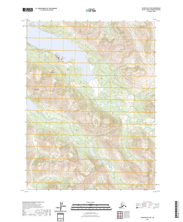
2024 Map of Seldovia B-5 SW
USGS Topo · Published 2024About this map
Port Graham and Nanwalek anchor the coastal fringe of this Kenai Peninsula landscape, where the tides of Port Graham bay meet steep coastal ridges. The settlement at Port Graham is detailed with its local infrastructure, including Port Graham Airport, the Port Graham Cem, and a small street network consisting of Graham Road and First Street. The surrounding wilderness is largely encompassed by the Alaska Maritime National Wildlife Refuge, protecting a complex drainage system that includes the English Bay River and several tidal inlets like Johnson Slough and Ducan Slough. This modern survey illustrates the proximity of these isolated communities to the massive protected habitats of the refuge, highlighting a geography defined by narrow coastal access and significant vertical relief.
Find a feature on this map
19 named features on this map. Tap any name to fly to it.
Don’t see what you’re looking for? This feature index may not catch every label — zoom into the map to look around manually.
Map Details
Editions of this 2024 Seldovia B-5 SW Map
This is the sole edition of this map. No revisions or reprints were ever made.
Other maps of this area

1951 · Seldovia
USGS Topo · 1:250,000

1951 · Seldovia B-5
USGS Topo · 1:63,360

1951 · Seldovia A-6
USGS Topo · 1:63,360

1951 · Seldovia B-6
USGS Topo · 1:63,360

1952 · Seldovia A-6
USGS Topo · 1:63,360

1953 · Seldovia B-6
USGS Topo · 1:63,360

1953 · Seldovia A-5
USGS Topo · 1:63,360

1953 · Seldovia B-5
USGS Topo · 1:63,360

1963 · Seldovia
USGS Topo · 1:250,000
1987 · Seldovia B-6 NE
USGS Topo · 1:25,000