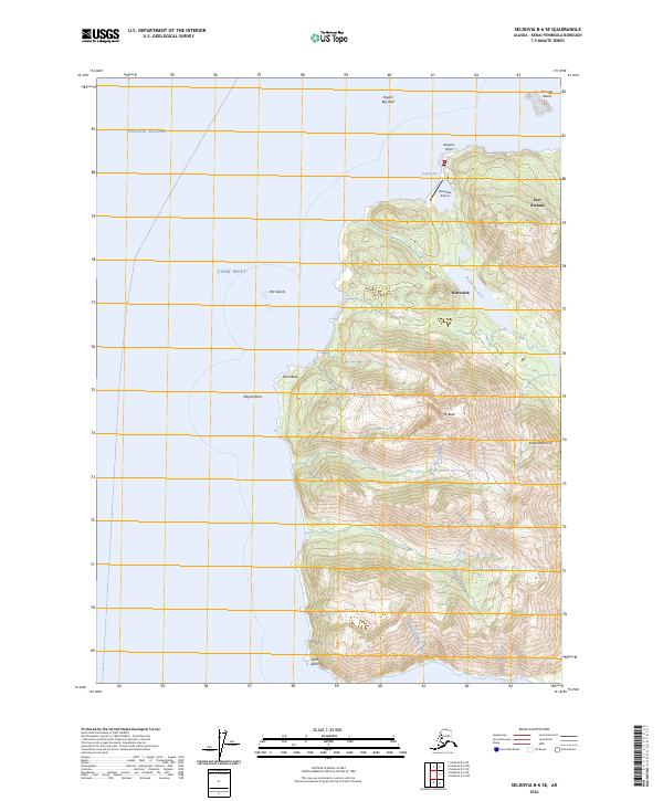
2024 Map of Seldovia B-6 SE
USGS Topo · Published 2024About this map
Nanwalek and Port Graham anchor the coastline on this southwestern tip of the Kenai Peninsula, where the marine environment of Cook Inlet meets the open Pacific Ocean. This modern survey details the vital transportation and subsistence infrastructure of these coastal communities, including the Nanwalek Airport and the complex drainage of the English Bay River. The landscape is dominated by steep coastal peaks rising to Mt Bede, while the surrounding waters are marked by navigational hazards and features such as English Bay Reef, Magnet Rock, and the Flat Islands. Most of the terrestrial area is protected under the Alaska Maritime National Wildlife Refuge, indicating a landscape largely preserved in its natural state, save for the established village sites and essential maritime markers like Point Bede and Point Adam.
Find a feature on this map
23 named features on this map. Tap any name to fly to it.
Don’t see what you’re looking for? This feature index may not catch every label — zoom into the map to look around manually.
Map Details
Editions of this 2024 Seldovia B-6 SE Map
This is the sole edition of this map. No revisions or reprints were ever made.
Other maps of this area

1951 · Seldovia
USGS Topo · 1:250,000

1951 · Seldovia B-5
USGS Topo · 1:63,360

1951 · Seldovia A-6
USGS Topo · 1:63,360

1951 · Seldovia B-6
USGS Topo · 1:63,360

1952 · Seldovia A-6
USGS Topo · 1:63,360

1953 · Seldovia B-6
USGS Topo · 1:63,360

1953 · Seldovia A-5
USGS Topo · 1:63,360

1953 · Seldovia B-5
USGS Topo · 1:63,360

1963 · Seldovia
USGS Topo · 1:250,000
1987 · Seldovia B-6 NE
USGS Topo · 1:25,000