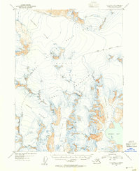
1953 Map of Seldovia D-1
USGS Topo · Published 1955About this map
Harding Icefield dominates this high-altitude landscape of the Kenai Mountains, where the vast frozen interior feeds numerous massive ice tongues. Mapped during the early 1950s using aerial photography, the topography reveals the intricate drainage patterns of the Mc Carty Glacier and Northwestern Glacier as they flow toward Harris Bay on the Gulf of Alaska. To the north and west, the terrain slopes toward the Tustumena Glacier and Chernof Glacier. The presence of the Kenai National Moose Range boundary indicates the early establishment of conservation zones in the territory. Glaciologists and researchers can use this 1953 record to study the historical extent of these ice masses, noting specific areas marked by crevasses and nunataks that pierce through the ice field's surface.
Find a feature on this map
11 named features on this map. Tap any name to fly to it.
Don’t see what you’re looking for? This feature index may not catch every label — zoom into the map to look around manually.
Map Details
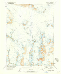
Editions of this 1953 Seldovia D-1 Map
2 editions found
Other maps of this area

1944 · Kenai
USGS Topo · 1:250,000

1946 · Blying Sound
USGS Topo · 1:250,000

1950 · Kenai
USGS Topo · 1:250,000

1950 · Seldovia D-2
USGS Topo · 1:63,360

1950 · Seward A-8
USGS Topo · 1:63,360

1951 · Blying Sound
USGS Topo · 1:250,000

1951 · Seward
USGS Topo · 1:250,000

1951 · Seldovia
USGS Topo · 1:250,000

1951 · Kenai A-2
USGS Topo · 1:63,360

1951 · Kenai A-1
USGS Topo · 1:63,360