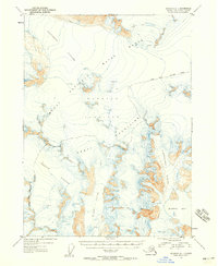
1953 Map of Seldovia D-1
USGS Topo · Published 1958About this map
The Harding Icefield dominates this 1953 topographic study, illustrating the glacial systems of the southern Kenai Peninsula before modern climate shifts. Large ice flows including Tustumena Glacier, Mc Carty Glacier, and Chernof Glacier carve through the Kenai Mountains, their surfaces marked by complex Crevasses. The map captures the wilderness character of the Kenai National Moose Range, documenting the northern boundary of the range as it was defined in the mid-20th century. To the southeast, the Northwestern Glacier descends toward the maritime terminus at Harris Bay. This map provides a baseline for geologists and environmental historians to track the terminus positions and ice volume of these major Alskan glacial systems during a period of relative stability before late-century retreat.
Find a feature on this map
11 named features on this map. Tap any name to fly to it.
Don’t see what you’re looking for? This feature index may not catch every label — zoom into the map to look around manually.
Map Details
Editions of this 1953 Seldovia D-1 Map
2 editions found
Other maps of this area

1944 · Kenai
USGS Topo · 1:250,000

1946 · Blying Sound
USGS Topo · 1:250,000

1950 · Kenai
USGS Topo · 1:250,000

1950 · Seldovia D-2
USGS Topo · 1:63,360

1950 · Seward A-8
USGS Topo · 1:63,360

1951 · Blying Sound
USGS Topo · 1:250,000

1951 · Seward
USGS Topo · 1:250,000

1951 · Seldovia
USGS Topo · 1:250,000

1951 · Kenai A-2
USGS Topo · 1:63,360

1951 · Kenai A-1
USGS Topo · 1:63,360