Loading...
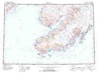
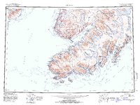
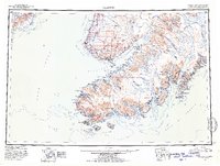
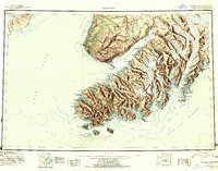
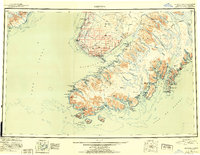
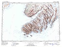
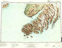
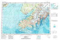
Loading map...1951 Map of Seldovia
USGS Topo · Published 1957About this map
The Kenai National Moose Range dominates the northeastern interior of this mid-century survey, a wilderness landscape marked by the Caribou Hills and the massive Grewingk Glacier. Along the coast of Cook Inlet, small settlements like Happy Valley and Anchor Pt reveal the early footprint of development on the Kenai Peninsula. The southern tip of the peninsula is punctuated by maritime and industrial sites, including a Coal Mine and the Seldovia Airport.
Find a feature on this map
135 named features on this map. Tap any name to fly to it.
Don’t see what you’re looking for? This feature index may not catch every label — zoom into the map to look around manually.
Map Details
Date Portrayed1951
Date Published1957
PublisherU.S. Geological Survey
Map TypeTopographic
Scale1:250,000
Physical Dimensions30.09 x 22.47 inches
Editions of this 1951 Seldovia Map
8 editions found

Historical Maps of Homer Through Time
Featured Locations
Source Details
SourceU.S. Geological Survey
CopyrightPublic Domain