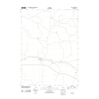
2011 Map of Seneca
USGS Topo · Published 2011About this map
The Middle Loup River winds eastward through this section of Thomas County, Nebraska, anchoring the small community of Seneca and its residential streets like Athens St and W Ave. This 2011 survey illustrates a sparse, ranching-oriented landscape where life is concentrated along the river valley and the primary transportation corridor of S Railroad St. The distribution of scattered homesteads across the Nebraska Sandhills is clearly visible through several family-named landmarks, including the Van Dusen Ranch to the north and the Walker Ranch in the southeast. The central village remains the hub of the area, housing the Seneca Post Office and connecting to the surrounding plains via Seneca Rd. The map provides a detailed view of the infrastructure that supports this cattle-country economy, from the bridge crossings over the Loup to the grid of rural access roads.
Find a feature on this map
15 named features on this map. Tap any name to fly to it.
Don’t see what you’re looking for? This feature index may not catch every label — zoom into the map to look around manually.
Map Details
Editions of this 2011 Seneca Map
This is the sole edition of this map. No revisions or reprints were ever made.
Other maps of this area

1948 · Seneca
USGS Topo · 1:62,500

1948 · Thedford
USGS Topo · 1:62,500

1948 · Seneca 4
USGS Topo · 1:62,500

1949 · Seneca 4
USGS Topo · 1:62,500

1950 · Thedford
USGS Topo · 1:62,500

1950 · Shimmins Lake
USGS Topo · 1:62,500

1951 · Seneca
USGS Topo · 1:62,500

1954 · North Platte
USGS Topo · 1:250,000

1956 · North Platte
USGS Topo · 1:250,000

1957 · North Platte
USGS Topo · 1:250,000