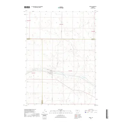
2017 Map of Seneca
USGS Topo · Published 2017About this map
Seneca occupies a narrow strip of developed land along the northern bank of the Middle Loup River in central Nebraska. This 2017 survey shows a compact residential grid structured around Broadway St and S Railroad St, reflecting a community historically tied to the transport corridor following the river valley. The surrounding landscape in Thomas Co and Hooker Co is characterized by the distinct, complex topography of the Sandhills, where numerous small depressions and drainage patterns contrast with the linear paths of S Seneca Ave and Seneca Rd. The convergence of county lines including Cherry Co just north of the settlement highlights its position as a local crossroads. Researchers can observe the interplay between the natural meandering of the river and the rigid township and range boundaries that define property and administrative divisions in this part of the Great Plains.
Find a feature on this map
19 named features on this map. Tap any name to fly to it.
Don’t see what you’re looking for? This feature index may not catch every label — zoom into the map to look around manually.
Map Details
Editions of this 2017 Seneca Map
This is the sole edition of this map. No revisions or reprints were ever made.
Other maps of this area

1948 · Seneca
USGS Topo · 1:62,500

1948 · Thedford
USGS Topo · 1:62,500

1948 · Seneca 4
USGS Topo · 1:62,500

1949 · Seneca 4
USGS Topo · 1:62,500

1950 · Thedford
USGS Topo · 1:62,500

1950 · Shimmins Lake
USGS Topo · 1:62,500

1951 · Seneca
USGS Topo · 1:62,500

1954 · North Platte
USGS Topo · 1:250,000

1956 · North Platte
USGS Topo · 1:250,000

1957 · North Platte
USGS Topo · 1:250,000