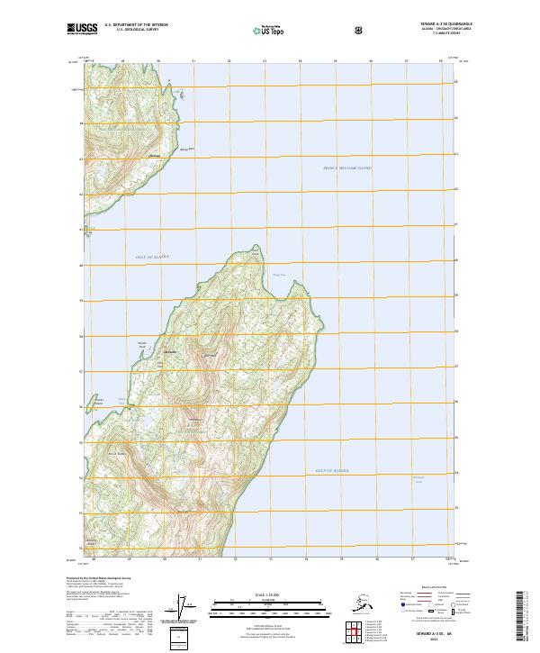
2023 Map of Seward A-3 SE
USGS Topo · Published 2023About this map
Latouche Island dominates this coastal landscape where the Gulf of Alaska meets the southeastern reaches of Prince William Sound. The island’s interior is defined by sharp elevation changes, notably at Mt Beatson and Gibbon Peak, while its western coastline is punctuated by small settlements like Latouche and Chenega. The presence of the Glory Hole water feature near the northern coast suggests a history of resource extraction or significant geological depression typical of this mineral-rich region.
Find a feature on this map
28 named features on this map. Tap any name to fly to it.
Don’t see what you’re looking for? This feature index may not catch every label — zoom into the map to look around manually.
Map Details
Editions of this 2023 Seward A-3 SE Map
This is the sole edition of this map. No revisions or reprints were ever made.
Other maps of this area

1946 · Blying Sound
USGS Topo · 1:250,000

1951 · Blying Sound
USGS Topo · 1:250,000

1951 · Seward
USGS Topo · 1:250,000

1951 · Seward A-2
USGS Topo · 1:63,360

1951 · Seward A-3
USGS Topo · 1:63,360

1951 · Blying Sound D-1 and D-2
USGS Topo · 1:63,360

1952 · Seward A-3
USGS Topo · 1:63,360

1953 · Seward A-2
USGS Topo · 1:63,360
1953 · Blying Sound D-3
USGS Topo · 1:63,360
1953 · Blying Sound D-1 and D-2
USGS Topo · 1:63,360