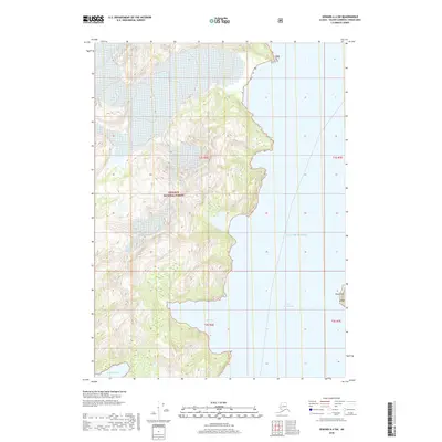
2018 Map of Seward A-4 SW
USGS Topo · Published 2018About this map
The coastal wilderness of the Chugach National Forest dominates this maritime survey, where steep terrain meets the deep waters of the Gulf of Alaska. The landscape is defined by its intricate shoreline, carved by Auk Bay and Goat Harbor along the western edge of the quadrangle. These natural inlets suggest the importance of small-vessel navigation and sheltered anchorage in a region where land-based infrastructure is entirely absent. On the eastern side, Port Bainbridge opens into the sea, punctuated by the distinct landmark of Point Pyke. The map illustrates a strictly preserved natural environment, focusing on the interface between glacial-scoured peaks and the Pacific inlets, providing a detailed record of the shoreline and elevation contours within the National Forest boundaries during the early twenty-first century.
Find a feature on this map
11 named features on this map. Tap any name to fly to it.
Don’t see what you’re looking for? This feature index may not catch every label — zoom into the map to look around manually.
Map Details
Editions of this 2018 Seward A-4 SW Map
This is the sole edition of this map. No revisions or reprints were ever made.
Other maps of this area

1946 · Blying Sound
USGS Topo · 1:250,000

1950 · Blying Sound D-4
USGS Topo · 1:63,360

1950 · Blying Sound D-5
USGS Topo · 1:63,360

1951 · Blying Sound
USGS Topo · 1:250,000

1951 · Seward
USGS Topo · 1:250,000

1951 · Seward A-5
USGS Topo · 1:63,360

1951 · Seward A-4
USGS Topo · 1:63,360

1952 · Seward A-5
USGS Topo · 1:63,360
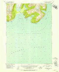
1952 · Blying Sound D-5
USGS Topo · 1:63,360

1952 · Seward A-4
USGS Topo · 1:63,360