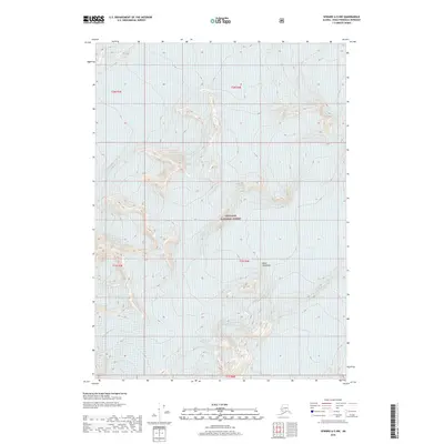
2018 Map of Seward A-5 NW
USGS Topo · Published 2018About this map
Chugach National Forest encompasses the high mountain terrain of the Kenai Peninsula in this 2018 topographic survey. This specific quadrangle, designated as Seward A-5 NW, is dominated by elevation contours that reveal steep ridges and glacial valleys. The absence of roads, buildings, or named settlements highlights the preserved wilderness character of this region of Alaska. Surveyed by the U.S. Geological Survey, the map provides precise data on the natural topography within township and range sections t2n r3e, t2n r4e, t1n r3e, t1n r4e, and t1s r4e. The intricate contour intervals offer a detailed look at the landforms where human infrastructure has not yet left a footprint.
Find a feature on this map
7 named features on this map. Tap any name to fly to it.
Don’t see what you’re looking for? This feature index may not catch every label — zoom into the map to look around manually.
Map Details
Editions of this 2018 Seward A-5 NW Map
This is the sole edition of this map. No revisions or reprints were ever made.
Other maps of this area

1950 · Seward A-6
USGS Topo · 1:63,360

1951 · Seward
USGS Topo · 1:250,000

1951 · Seward A-6
USGS Topo · 1:63,360

1951 · Seward A-5
USGS Topo · 1:63,360

1951 · Seward B-6
USGS Topo · 1:63,360

1951 · Seward B-5
USGS Topo · 1:63,360

1952 · Seward A-5
USGS Topo · 1:63,360

1952 · Seward B-6
USGS Topo · 1:63,360

1952 · Seward B-5
USGS Topo · 1:63,360

1953 · Seward
USGS Topo · 1:250,000