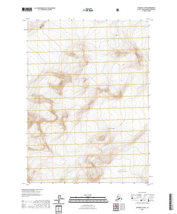
2023 Map of Seward A-5 NW
USGS Topo · Published 2023About this map
Chenega Glacier dominates the ice-carved topography of this high-latitude terrain, where steep-walled valleys and glacial tongues shape the northern Kenai Peninsula. This 2023 edition captures a landscape defined by dramatic elevation changes, with the frozen mass of the glacier feeding the hydrological systems of the surrounding Chugach National Forest. The map is characterized by its isolation and the relative absence of human infrastructure, focusing instead on the intersection of maritime and glacial influences. Significant township and range boundaries, such as t1n r4e and t2n r4e, delineate the remote wilderness within the national forest system, providing a precise topographic record of this protected Alaskan environment.
Find a feature on this map
8 named features on this map. Tap any name to fly to it.
Don’t see what you’re looking for? This feature index may not catch every label — zoom into the map to look around manually.
Map Details
Editions of this 2023 Seward A-5 NW Map
This is the sole edition of this map. No revisions or reprints were ever made.
Other maps of this area

1950 · Seward A-6
USGS Topo · 1:63,360

1951 · Seward
USGS Topo · 1:250,000

1951 · Seward A-6
USGS Topo · 1:63,360

1951 · Seward A-5
USGS Topo · 1:63,360

1951 · Seward B-6
USGS Topo · 1:63,360

1951 · Seward B-5
USGS Topo · 1:63,360

1952 · Seward A-5
USGS Topo · 1:63,360

1952 · Seward B-6
USGS Topo · 1:63,360

1952 · Seward B-5
USGS Topo · 1:63,360

1953 · Seward
USGS Topo · 1:250,000