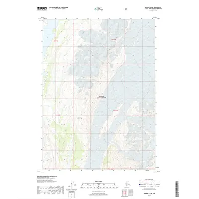
2018 Map of Seward A-6 NE
USGS Topo · Published 2018About this map
The high-elevation terrain of the Kenai Peninsula dominates this 2018 survey, characterized by the steep vertical relief of the Chugach Mountains. Much of the eastern and central portion of the map is protected within the Chugach National Forest, where the landscape is defined by massive glacial cirques and ice-carved ridges. The most prominent hydrologic feature is Nellie Juan Lake, located in the northwestern corner of the quadrangle. This glacial-fed body of water sits in a high basin, surrounded by contours that indicate extreme changes in elevation. The absence of roads or permanent settlements reflects the wilderness character of this region, providing a detailed record of the natural hydrography and topographical boundaries including t2n r2e and t1n r3e at the time of publication.
Find a feature on this map
8 named features on this map. Tap any name to fly to it.
Don’t see what you’re looking for? This feature index may not catch every label — zoom into the map to look around manually.
Map Details
Editions of this 2018 Seward A-6 NE Map
This is the sole edition of this map. No revisions or reprints were ever made.
Other maps of this area

1950 · Seward A-6
USGS Topo · 1:63,360

1951 · Seward
USGS Topo · 1:250,000

1951 · Seward A-6
USGS Topo · 1:63,360

1951 · Seward A-5
USGS Topo · 1:63,360

1951 · Seward B-6
USGS Topo · 1:63,360

1951 · Seward B-5
USGS Topo · 1:63,360

1952 · Seward A-5
USGS Topo · 1:63,360

1952 · Seward B-6
USGS Topo · 1:63,360

1952 · Seward B-5
USGS Topo · 1:63,360

1953 · Seward
USGS Topo · 1:250,000