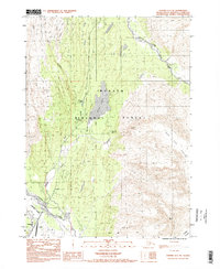
1983 Map of Seward A-7 NE
USGS Topo · Published 1998About this map
Seward and its northern outskirts emerge from the glacial landscape of the Kenai Peninsula in this early 1980s topographical record. The settlement of Woodrow is situated between the banks of Salmon Creek and the western shore of Bear Lake, illustrating the constrained corridor of human activity in this mountainous region. Transport infrastructure is concentrated near the coast, including the Seward Airport and a small Cem located near the Resurrection River.
Find a feature on this map
18 named features on this map. Tap any name to fly to it.
Don’t see what you’re looking for? This feature index may not catch every label — zoom into the map to look around manually.
Map Details
Editions of this 1983 Seward A-7 NE Map
2 editions found
Other maps of this area

1950 · Seward A-6
USGS Topo · 1:63,360

1950 · Seward A-7
USGS Topo · 1:63,360

1951 · Seward
USGS Topo · 1:250,000

1951 · Seward A-6
USGS Topo · 1:63,360

1951 · Seward A-7
USGS Topo · 1:63,360

1951 · Seward B-7
USGS Topo · 1:63,360

1951 · Seward B-6
USGS Topo · 1:63,360

1952 · Seward B-6
USGS Topo · 1:63,360

1953 · Seward B-7
USGS Topo · 1:63,360

1953 · Seward
USGS Topo · 1:250,000