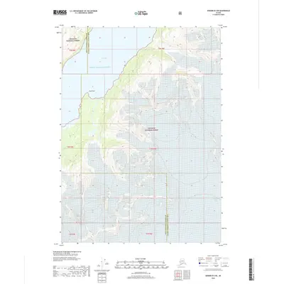
2018 Map of Seward B-5 NE
USGS Topo · Published 2018About this map
Prince William Sound dominates the northwestern portion of this 2018 survey, where the waters of Kings Bay meet the shoreline at Kings Point. This maritime landscape is defined by the massive ice fields of the Chugach National Forest, which feed a series of named ice flows descending toward the coast. The topography reveals the dramatic elevation changes characteristic of the region, specifically where the Applegate Glacier and Kings Glacier dominate the central peaks. To the east and south, the ice continues with Falling Glacier, Langdon Glacier, and Princeton Glacier. The map also delineates the administrative boundary between the Kenai Peninsula Borough and the Valdez-Cordova Census Area, which cuts through the mountainous interior. This document serves as a precise record of glacial positions and coastal contours in the early 21st century.
Find a feature on this map
10 named features on this map. Tap any name to fly to it.
Don’t see what you’re looking for? This feature index may not catch every label — zoom into the map to look around manually.
Map Details
Editions of this 2018 Seward B-5 NE Map
This is the sole edition of this map. No revisions or reprints were ever made.
Other maps of this area

1951 · Seward
USGS Topo · 1:250,000

1951 · Seward B-4
USGS Topo · 1:63,360

1951 · Seward C-5
USGS Topo · 1:63,360

1951 · Seward B-5
USGS Topo · 1:63,360

1951 · Seward C-4
USGS Topo · 1:63,360

1952 · Seward B-4
USGS Topo · 1:63,360

1952 · Seward C-5
USGS Topo · 1:63,360

1952 · Seward B-5
USGS Topo · 1:63,360

1952 · Seward C-4
USGS Topo · 1:63,360

1953 · Seward
USGS Topo · 1:250,000