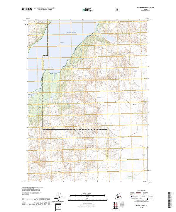
2023 Map of Seward B-5 NE
USGS Topo · Published 2023About this map
Chugach National Forest dominates this coastal Alaska landscape, where massive ice fields meet the saltwater of Kings Bay and the Pacific Ocean. This modern survey records the retreat and flow of numerous named ice bodies, including the expansive Applegate Glacier, Nellie Juan Glacier, and Kings Glacier. These features represent a snapshot of the changing glacial environment of the Kenai Peninsula, providing critical data for understanding the hydrological and geological evolution of the region.
Find a feature on this map
18 named features on this map. Tap any name to fly to it.
Don’t see what you’re looking for? This feature index may not catch every label — zoom into the map to look around manually.
Map Details
Editions of this 2023 Seward B-5 NE Map
This is the sole edition of this map. No revisions or reprints were ever made.
Other maps of this area

1951 · Seward
USGS Topo · 1:250,000

1951 · Seward B-4
USGS Topo · 1:63,360

1951 · Seward C-5
USGS Topo · 1:63,360

1951 · Seward B-5
USGS Topo · 1:63,360

1951 · Seward C-4
USGS Topo · 1:63,360

1952 · Seward B-4
USGS Topo · 1:63,360

1952 · Seward C-5
USGS Topo · 1:63,360

1952 · Seward B-5
USGS Topo · 1:63,360

1952 · Seward C-4
USGS Topo · 1:63,360

1953 · Seward
USGS Topo · 1:250,000