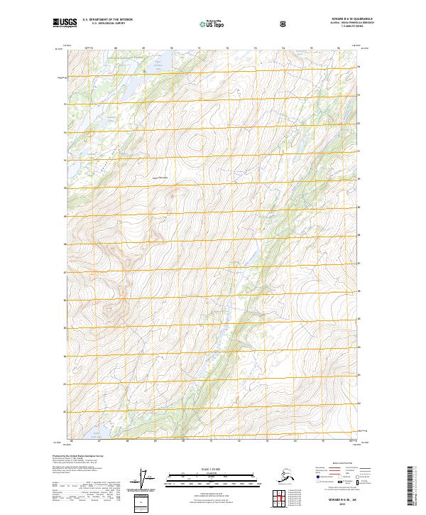
2023 Map of Seward B-6 SE
USGS Topo · Published 2023About this map
Chugach National Forest land dominates this section of the Kenai Peninsula, where a network of glacial waters and mountain valleys defines the wilderness. The Nellie Juan River serves as the primary drainage for the eastern portion of the sheet, originating near Nellie Juan Lake and winding through the steep terrain. To the west, the Snow River and the chain of Paradise Lakes occupy the deep Paradise Valley, illustrating the classic U-shaped glacial carving of the region. The map highlights the high-elevation reach of Wolverine Glacier and its runoff into Wolverine Creek, providing a contemporary record of ice and water patterns in this protected landscape. The Absence of established roads or settlements emphasizes the remote nature of this forest interior as it was surveyed in the early 2020s.
Find a feature on this map
14 named features on this map. Tap any name to fly to it.
Don’t see what you’re looking for? This feature index may not catch every label — zoom into the map to look around manually.
Map Details
Editions of this 2023 Seward B-6 SE Map
This is the sole edition of this map. No revisions or reprints were ever made.
Other maps of this area

1950 · Seward A-6
USGS Topo · 1:63,360

1951 · Seward
USGS Topo · 1:250,000

1951 · Seward A-6
USGS Topo · 1:63,360

1951 · Seward A-5
USGS Topo · 1:63,360

1951 · Seward B-6
USGS Topo · 1:63,360

1951 · Seward B-5
USGS Topo · 1:63,360

1952 · Seward A-5
USGS Topo · 1:63,360

1952 · Seward B-6
USGS Topo · 1:63,360

1952 · Seward B-5
USGS Topo · 1:63,360

1953 · Seward
USGS Topo · 1:250,000