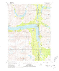
1951 Map of Seward B-7
USGS Topo · Published 1981About this map
The Alaska Railroad and the Sterling Highway form the industrial backbone of this Kenai Peninsula landscape, tracing a narrow corridor of human activity through the Chugach National Forest. Small settlements like Moose Pass and Lawing are established along the shores of Upper Trail Lake and Kenai Lake, serving as vital transit points in an area defined by steep terrain and glacially carved valleys.
Find a feature on this map
59 named features on this map. Tap any name to fly to it.
Don’t see what you’re looking for? This feature index may not catch every label — zoom into the map to look around manually.
Map Details
Editions of this 1951 Seward B-7 Map
4 editions found
Other maps of this area

1950 · Seward A-6
USGS Topo · 1:63,360

1950 · Seward A-8
USGS Topo · 1:63,360

1950 · Seward A-7
USGS Topo · 1:63,360

1951 · Seward
USGS Topo · 1:250,000

1951 · Seward A-6
USGS Topo · 1:63,360

1951 · Seward A-7
USGS Topo · 1:63,360

1951 · Seward B-7
USGS Topo · 1:63,360

1951 · Seward C-6
USGS Topo · 1:63,360

1951 · Seward B-6
USGS Topo · 1:63,360

1951 · Seward C-8
USGS Topo · 1:63,360