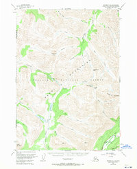
1951 Map of Seward C-8
USGS Topo · Published 1970About this map
The Kenai Mountains dominate this high-country landscape within the Chugach National Forest, where a network of trails and waterways provides the primary navigation through the interior. The Resurrection Pass Trail follows the valley of Resurrection Creek, crossing through Resurrection Pass and Devils Pass as it connects the northern drainage toward the Chickaloon River.
Find a feature on this map
38 named features on this map. Tap any name to fly to it.
Don’t see what you’re looking for? This feature index may not catch every label — zoom into the map to look around manually.
Map Details
Editions of this 1951 Seward C-8 Map
3 editions found
Other maps of this area

1944 · Kenai
USGS Topo · 1:250,000

1950 · Kenai
USGS Topo · 1:250,000

1950 · Kenai B-1
USGS Topo · 1:63,360

1951 · Seward
USGS Topo · 1:250,000

1951 · Kenai C-1
USGS Topo · 1:63,360

1951 · Seward B-7
USGS Topo · 1:63,360

1951 · Kenai D-1
USGS Topo · 1:63,360

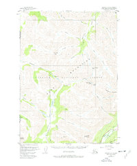
1951 · Seward C-8
USGS Topo · 1:63,360

1951 · Seward D-8
USGS Topo · 1:63,360

1951 · Seward D-7
USGS Topo · 1:63,360