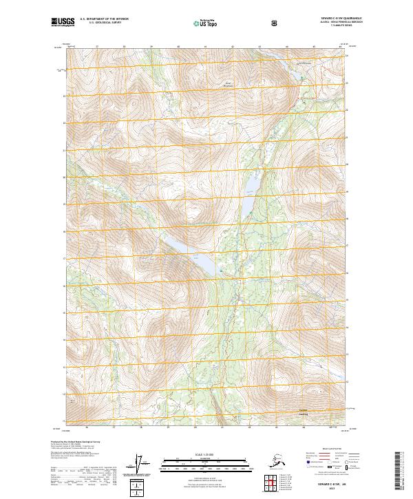
2023 Map of Seward C-8 SW
USGS Topo · Published 2023About this map
Cooper Landing serves as a focal point at the southern edge of this high-elevation landscape within the Chugach National Forest. The map documents a critical corridor for interior travel across the Kenai Peninsula, dominated by the steep rises of the Kenai Mountains. Water systems define the drainage patterns of the region, including the north-flowing Chickaloon River and the complex network of Juneau Creek, which connects Juneau Lake and Trout Lake.
Find a feature on this map
22 named features on this map. Tap any name to fly to it.
Don’t see what you’re looking for? This feature index may not catch every label — zoom into the map to look around manually.
Map Details
Editions of this 2023 Seward C-8 SW Map
This is the sole edition of this map. No revisions or reprints were ever made.
Other maps of this area

1944 · Kenai
USGS Topo · 1:250,000

1950 · Kenai
USGS Topo · 1:250,000

1950 · Kenai B-1
USGS Topo · 1:63,360

1951 · Seward
USGS Topo · 1:250,000

1951 · Kenai C-1
USGS Topo · 1:63,360

1951 · Seward C-8
USGS Topo · 1:63,360

1951 · Seward B-8
USGS Topo · 1:63,360

1952 · Kenai C-1
USGS Topo · 1:63,360

1952 · Kenai B-1
USGS Topo · 1:63,360

1952 · Seward C-8
USGS Topo · 1:63,360