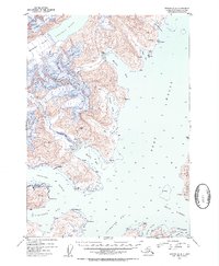
1952 Map of Seward D-4
USGS Topo · Published 1954About this map
Harriman Fiord and the surrounding coastal wilderness of the Chugach National Forest define this 1952 topographic study of Prince William Sound. The landscape is dominated by active glacial systems, including the massive Harriman Glacier, Roaring Glacier, and Dirty Glacier, which feed directly into the deep marine waters. Evidence of early 20th-century industry is visible through the Granite Mine near Harrison Lagoon and the Lansing Mine overlooking Bettles Bay, marking the era's mineral exploration. Navigational aids like the Pt Pigot Light and landmarks such as Decision Pt guide the way through Passage Canal and Port Wells. Localized activity is noted at Logging Camp Bay and various scattered Cabin sites, reflecting a period of temporary maritime and resource-based settlement along the shoreline of Blackstone Bay and Cochrane Bay.
Find a feature on this map
42 named features on this map. Tap any name to fly to it.
Don’t see what you’re looking for? This feature index may not catch every label — zoom into the map to look around manually.
Map Details
Editions of this 1952 Seward D-4 Map
2 editions found

Other maps of this area

1951 · Seward
USGS Topo · 1:250,000

1951 · Anchorage
USGS Topo · 1:250,000

1951 · Seward D-5
USGS Topo · 1:63,360

1951 · Seward C-5
USGS Topo · 1:63,360

1951 · Seward D-4
USGS Topo · 1:63,360

1951 · Seward D-3
USGS Topo · 1:63,360

1951 · Seward C-4
USGS Topo · 1:63,360

1951 · Seward C-3
USGS Topo · 1:63,360

1952 · Seward D-5
USGS Topo · 1:63,360

1952 · Seward D-3
USGS Topo · 1:63,360